


Detect. Predict. Protect.
And close the case before the shift ends.
Drone Sky Defender | Capability brief for law enforcement, DHS, and TSA
The call still starts the same way: drone over the site. What used to happen next was a scramble. Units looked up. Dispatch looked for a pilot. Airport or venue ops held a posture. Someone eventually wrote “unidentified UAS, departed unknown direction.”
That is not an investigation. That is lost time.
Drone Sky Defender was built to give agencies the advantage the capability statement names outright: time. Not another map pin. Predictive intelligence that tells you what the aircraft will do next — and an FAA compliance layer that tells you, in the first minute, whether the flight is even legal.
The technology we unveiled
Drone Sky Defender is not a single sensor. It is a patent-pending predictive engine sitting on top of whatever you already use to see the sky.

Toxic Plume dispersion from a drone at altitude using live weather. (Patent Pending)
The software is platform-agnostic by design. It fuses Remote ID, RF, EO/IR, thermal, radar, or a third-party feed. You keep the systems you paid for. We turn that raw stream into operational intelligence.
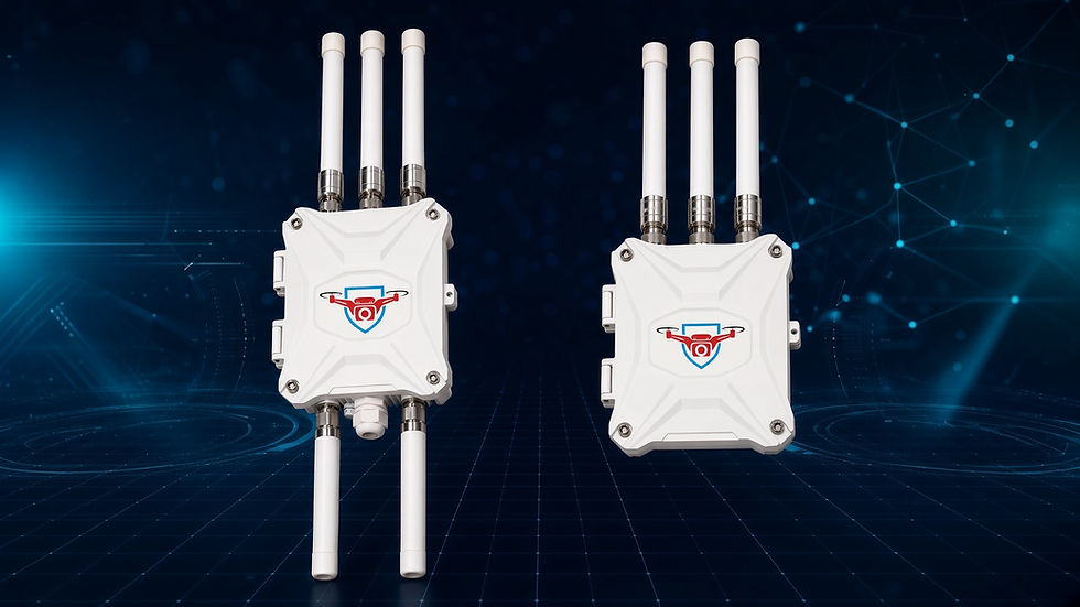
The hardware side is turnkey when you need it: detection units pre-installed and ready to deploy, plug-and-play, built in the USA. The mission set on the flyer is the one we actually serve — law enforcement, corrections, airports, military, critical infrastructure, public safety, utilities, ports and maritime, events and venues.
We don’t just tell you where the drone is. We tell you what it will do next — and why.
Patent-pending predictive products
Detection answers where. Prediction answers what happens if we wait.
Our patent-pending engine is designed to take live data and produce capabilities:
Capability | What the operator gets |
Direction prediction | A projected path from real-time movement, speed, heading, and behavior — not a stale last ping |
Launch-origin backtrace | A probable launch point, including when the aircraft is already airborne |
Intent analysis | Flight behavior, timing, and environment scored against likely mission type |
Threat and risk scoring | Dynamic level based on infrastructure proximity, payload indicators, history, and behavior |
Infrastructure impact modeling | Which assets are actually in the cone of risk, and how bad a miss would be |
Swarm behavior analysis | Coordinated activity, roles, and whether this is one aircraft or a set |
RF evasion detection | Abnormal RF, jamming attempts, stealth tactics |
Decision support | A recommended posture, not a raw plot |
Predict early. Prioritize smart. Respond first.
That is the difference between rolling the whole watch and sending the right two people to the right fence line. Corrections care about the drop point. Airports care about the surface. Stadiums care about the bowl. DHS and TSA care about all three before the aircraft is overhead.

Neuiral Fingerprinting (Patent Pending)
The FAA compliance module: the first cut that saves the hour
Predictive software is wasted if the first question on the call is still unanswered: is this aircraft even allowed to be here?
The FAA Remote ID Compliance Module is the listener that answers it.
Under 14 CFR Part 89, most registered drones — generally 250 grams and up, and any aircraft flown under Part 107 — must broadcast Remote ID unless they are inside an FAA-Recognized Identification Area. That broadcast is the digital license plate. It can carry the serial number, the aircraft position, and, depending on the equipment, the control-station or takeoff location.
The module hears those RID broadcasts. For a pilot, that is a pre-flight check: will I be legal? For a deputy, a TSA coordinator, or a DHS component, it is the start of the case file.
What it gives you in the first minute
Broadcast or no broadcast. A visual drone with no Part 89 signal is already a different case than a compliant survey. You stop burning the opening of the incident assuming it is “probably authorized.”
A serial number you can run. Authorized law enforcement can take that serial to the FAA’s DiSCVR tool through DHS channels and, when a match exists, pull registration and check DroneZone and LAANC authorizations for that place and time.
A position on the aircraft — and often on the pilot. Standard Remote ID includes control-station location. A broadcast module gives takeoff location. Either beats a 360-degree parking-lot search.
A log that survives the shift. Time, identifier, track, geofence hit. That is what goes in the affidavit, the airport security report, or the fusion-center packet.
The module is passive. It does not talk to the aircraft. It does not jam. It does not require a mitigation authority you may not have. It records what the law already requires the aircraft to say out loud.
How that saves time for law enforcement, DHS, and TSA
An airspace-violation job without RID capture is a scavenger hunt. With the compliance module on a networked Drone Sky Defender deployment, the same job becomes a fork:
Cleared. Broadcast present. Registration and authorization check out. No geofence or TFR rule broken. Units stand down. TSA and airport ops stop holding a posture for a news crew that filed a LAANC.
Violation. No required broadcast, or a broadcast that does not match an authorization for that grid and window. You have a Part 89 fact, a serial, a track, and a timestamp — not a feeling.

Threat track. Predictive score, launch estimate, and infrastructure impact go to the people who can act. Swarm or RF-evasion flags change the posture again.
That is how you avoid the two expensive errors: treating a permitted flight like a threat, and treating a real violation like weather.

Kinetic Payload Assessment
For local and state law enforcement, it is fewer units circling, a cleaner report, and a serial that fusion can run. For DHS components, it is a record that matches how DiSCVR and GII actually work — they need an identifier, not a description of a silhouette. For TSA and airport operators, it is the difference between a terminal-wide distraction and a closed loop: listen, geofence the movement area, alert on the rule you wrote, hand the serial up only when the flight is not obviously authorized.
Historical logs close the repeat-offender question that used to take weeks: have we seen this serial over this jail, this terminal, this stadium before?
Built for the mission, not the brochure
The rest of the capability statement is the operating model:
Gain time — see the future, not just the present
Reduce risk — act before the incident
Increase effectiveness — put people where the track is going
Protect what matters — people, assets, operations, communities
Flexible and scalable — site, city, or network
Made in the USA — built for reliability, built for you
Support and training are part of the delivery, not an add-on after the invoice. We are a certified Service-Disabled Veteran-Owned Small Business. CAGE 13PD0. UEI KG88GQATTT68.
The five-minute standard
If a drone is over a restricted site, the first five minutes should produce a decision, not a huddle.
The FAA compliance module gets you to the fork. The patent-pending predictive products tell you which side of the fork is on fire. Together they turn “drone over the facility” from an open-ended scramble into a case you can clear, cite, or escalate before the aircraft is gone and the report is empty.
The future of counter-UAS is predictive. Let us show you what is next.
Drone Sky DefenderYour sentinel of the skies info@droneskydefender.com · www.droneskydefender.com CAGE 13PD0 · UEI KG88GQATTT68Certified Service-Disabled Veteran-Owned Small Business
Patent-pending technology. Remote ID detection is passive and does not interfere with aircraft. DiSCVR and FAA registration lookup are federal capabilities available to authorized users; Drone Sky Defender provides the field capture, logging, fusion, and predictive layer that makes those tools usable on a live call. Not every aircraft is required to broadcast. A serial number is a lead, not a conviction.


Comments